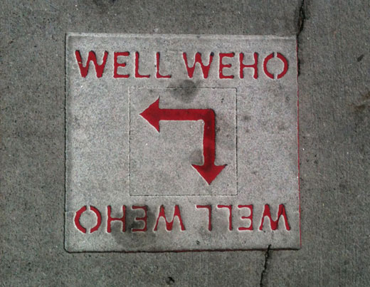
You’re not standing above a city water reservoir; these markers were part of a 2007 program called “Well West Hollywood.” The program mapped, measured and marked 2.5-mile paths through the city to promote fitness.
There are three paths: The red arrows lead you uphill — they don’t call it the Cardio/Historic Route for nothing — from Kings Road Park past a string of historic buildings to Formosa. Like parks? The yellow markers take you from West Hollywood Park to two others, Kings Road and Plummer. Curious what the neighborhood west of the PDC is like? Follow the blue arrows, starting at Santa Monica and San Vicente, in a convenient loop.
Tie your shoes and follow the arrows, fitness is built into the city infrastructure.
See the yellow path map here.
