Wonder where the homeless are, and what local government is doing to help them? Los Angeles County today unveiled an online planning tool to guide efforts to create interim and supportive housing to address the homelessness crisis.
“This planning tool provides a powerful and transparent roadmap for how we should be moving forward to address this crisis,” said county CEO Sachi A. Hamai, who presented the tool today to the L.A. County Board of Supervisors. “It offers a unique visual presentation that shows the important efforts now underway—but also demonstrates the hard work that lies ahead.”
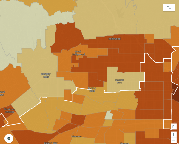
The map draws on data from the Los Angeles Homeless Services Authority’s January 2019 Point in Time Count, which reported nearly 59,000 people experiencing homelessness across Los Angeles County—more than 44,000 of them unsheltered. That on-street survey conducted Jan. 22-24 identified 131 homeless people in West Hollywood, a 31% increase over the 100 homeless people counted in 2018.
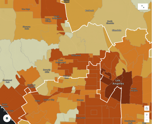
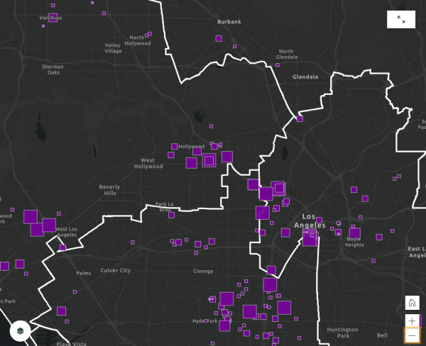
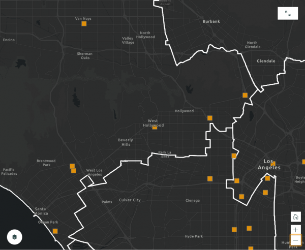
The map makes it possible to view the homeless population data geographically, while adding layers that show existing supportive and interim housing, as well as housing that is currently being developed.
In an announcement of the tool, the county’s Communications Office said “it reflects the unprecedented development underway to create more supportive housing than ever before in the County’s history. It also visually demonstrates gaps between where the need is and where projects currently exist or are being developed.”
“We look forward to continuing to grow the usefulness of this planning tool as we attack this crisis with all the resources at our disposal,” Hamai said. Additional data will be added in the months ahead.
The map can be accessed by clicking here. It isn’t compatible with Internet Explorer, so another browser must be used.